Last checked Due a review
Key facts
- Duration
- 14 to 21 days on the trail depending on start point
- Highest point
- 5,416 m (17,769 ft) at Thorong La Pass
- Total distance
- 210 km
- Difficulty
- Challenging, 3 of 5
- Best months
- March to April and October to November
- Months to avoid
- January to February and June to August
- Starts and ends
- Besisahar or Chame (for road-shortened version) to Pokhara via Jomsom or Nayapul
- Accommodation
- Teahouse lodges
- Permits
- Annapurna Conservation Area Permit (ACAP), TIMS Card
- Typical cost
- $900 to $2,200 per person, guided
- Experience needed
- No technical climbing skills needed, but prior multi-day trekking experience is strongly recommended.
How has road construction changed the Annapurna Circuit?
A road now runs alongside much of the lower and eastern sections of the circuit, reducing the wilderness feel. Most experienced trekkers now start at Chame or Dharapani to skip the motorable lower sections.
The Annapurna Circuit has changed significantly since the 1980s when it was widely considered the world's greatest trek. A road now runs from Besisahar to Manang and another from Jomsom down to Beni. These roads have brought development and reduced the sense of remoteness in the lower sections.
The solution is straightforward: start higher. Beginning at Chame (accessible by jeep) and exiting at Jomsom by flight or jeep skips the worst sections and saves 3 to 4 days without sacrificing any of the high-altitude highlights.
How should I prepare for Thorong La?
Thorong La is serious. A full rest day at Manang is mandatory, not optional. Many failed crossings are by trekkers who rushed the acclimatisation stages.
The pass at 5,416 m is the highest point on any standard teahouse route in the Himalayas. The combination of altitude, cold, and the length of the crossing day mean you should arrive at it well-rested and properly acclimatised.
The mandatory strategy: spend two nights at Manang and do the Ice Lake day hike for active acclimatisation. Move to High Camp the day before the crossing. Leave by 4am to be at the summit before noon and clear the descent before afternoon cloud and wind make the trail treacherous.
Annapurna Circuit Trek itinerary, day by day
The full 16 day schedule, with sleeping altitude, walking hours and overnight stop for every day. The acclimatisation days are the ones that decide whether people finish.
Day 1
Kathmandu or Pokhara to Besisahar
- 760 m
- Rest day
- 175 km
- Sleep: Besisahar
Travel to the circuit trailhead in the Marsyangdi River valley.
Read the dayShow less
Besisahar is the gateway town. Most trekkers take a morning bus from Kathmandu or Pokhara. Organise permits here if not already done.
Transport: Bus 6 to 7 hours from Kathmandu or 4 hours from Pokhara
Day 2
Besisahar to Bahundanda
- 1,310 m
- Up 550 m
- 16 km
- 5 to 6 h
- Sleep: Bahundanda
Enter the Annapurna Conservation Area and begin climbing through rice terraces and subtropical forest.
Read the dayShow less
The lower Marsyangdi valley is lush and warm. Bahundanda is a ridge-top village with views back down the valley. Many trekkers begin at Bhulbhule to skip the road section below Bahundanda.
Day 3
Bahundanda to Chamje
- 1,430 m
- Up 120 m
- 12 km
- 4 to 5 h
- Sleep: Chamje
Follow the Marsyangdi River through deep gorge terrain.
Read the dayShow less
The trail drops and climbs across several suspension bridges as the river cuts through a narrow gorge. Waterfalls cascade from the cliffs above.
Day 4
Chamje to Chame
- 2,670 m
- Up 1,240 m
- 20 km
- 6 to 7 h
- Sleep: Chame
Significant altitude gain as the valley narrows and pines replace subtropical species.
Read the dayShow less
Chame is the district headquarters of Manang and the best supplied town on the circuit. Hot springs are available near Khotro, a short walk south. Stock up on supplies here.
Day 5
Chame to Upper Pisang
- 3,310 m
- Up 640 m
- 17 km
- 5 to 6 h
- Sleep: Upper Pisang
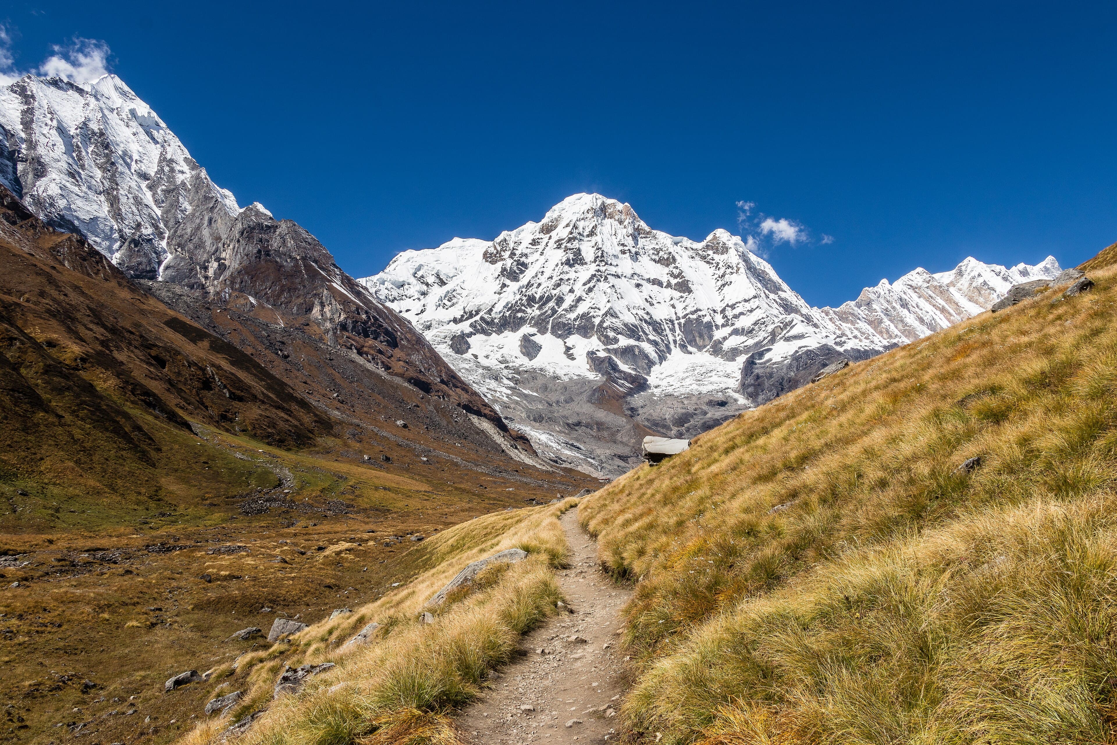
First views of Annapurna II. The Paungda Danda rock face is one of the most dramatic on the trek.
Read the dayShow less
Take the high route via Upper Pisang for better mountain views and a more authentic village experience. The curved rock face of Paungda Danda (2 km wide, 1.5 km high) is a striking geological feature.
Highlight: First views of Annapurna II (7,937 m)
Day 6
Upper Pisang to Manang
- 3,500 m
- Up 190 m
- 20 km
- 5 to 6 h
- Sleep: Manang
Enter the arid Manang valley with views of the Annapurna range across a glacial plateau.
Read the dayShow less
Cross into the rain shadow. The vegetation changes abruptly to scrubby juniper and the air becomes noticeably drier and crisper. Manang is the main acclimatisation hub before the pass.
Day 7
Acclimatisation Day at Manang
- 3,800 m
- Up 300 m
- 8 km
- 3 to 4 h
- Sleep: Manang
Essential rest day. Hike to the Gangapurna Lake or Ice Lake for acclimatisation.
Read the dayShow less
Do not rush this day. The Himalayan Rescue Association has a clinic in Manang that gives an excellent afternoon talk on altitude sickness — strongly recommended. Hike to Ice Lake (4,600 m) for acclimatisation.
Day 8
Manang to Yak Kharka
- 4,018 m
- Up 518 m
- 10 km
- 3 to 4 h
- Sleep: Yak Kharka
Begin the climb toward the pass. Yak herders' pastures and open sky.
Read the dayShow less
A short but important acclimatisation stage. Above the tree line now, with views across to the Annapurna range. Yak Kharka is named for the yak pastures that define the landscape.
Day 9
Yak Kharka to Thorong Phedi
- 4,540 m
- Up 522 m
- 8 km
- 3 to 4 h
- Sleep: Thorong Phedi High Camp
Move to the base of the pass. Sleep as high as possible for an early start.
Read the dayShow less
Most trekkers continue beyond Thorong Phedi to High Camp at 4,850 m, reducing the ascent time the following morning. Prepare all gear tonight.
Day 10
Thorong Phedi over Thorong La to Muktinath
- 3,760 m
- Down 1,090 m
- 16 km
- 7 to 9 h
- Sleep: Muktinath
The great crossing. Thorong La at 5,416 m is the highest trekking pass in the world regularly crossed by teahouse trekkers.
Read the dayShow less
Leave at 4am from High Camp. The ascent to the pass takes 3 to 4 hours in the cold and dark. At the pass, flags and a stone cairn mark the high point. The descent to Muktinath is long and steep — allow 3 to 4 hours. Muktinath is a major Hindu and Buddhist pilgrimage site.
Highlight: Thorong La at 5,416 m — the high point of the entire circuit
Day 11
Muktinath to Jomsom
- 2,720 m
- Down 1,040 m
- 20 km
- 5 to 6 h
- Sleep: Jomsom
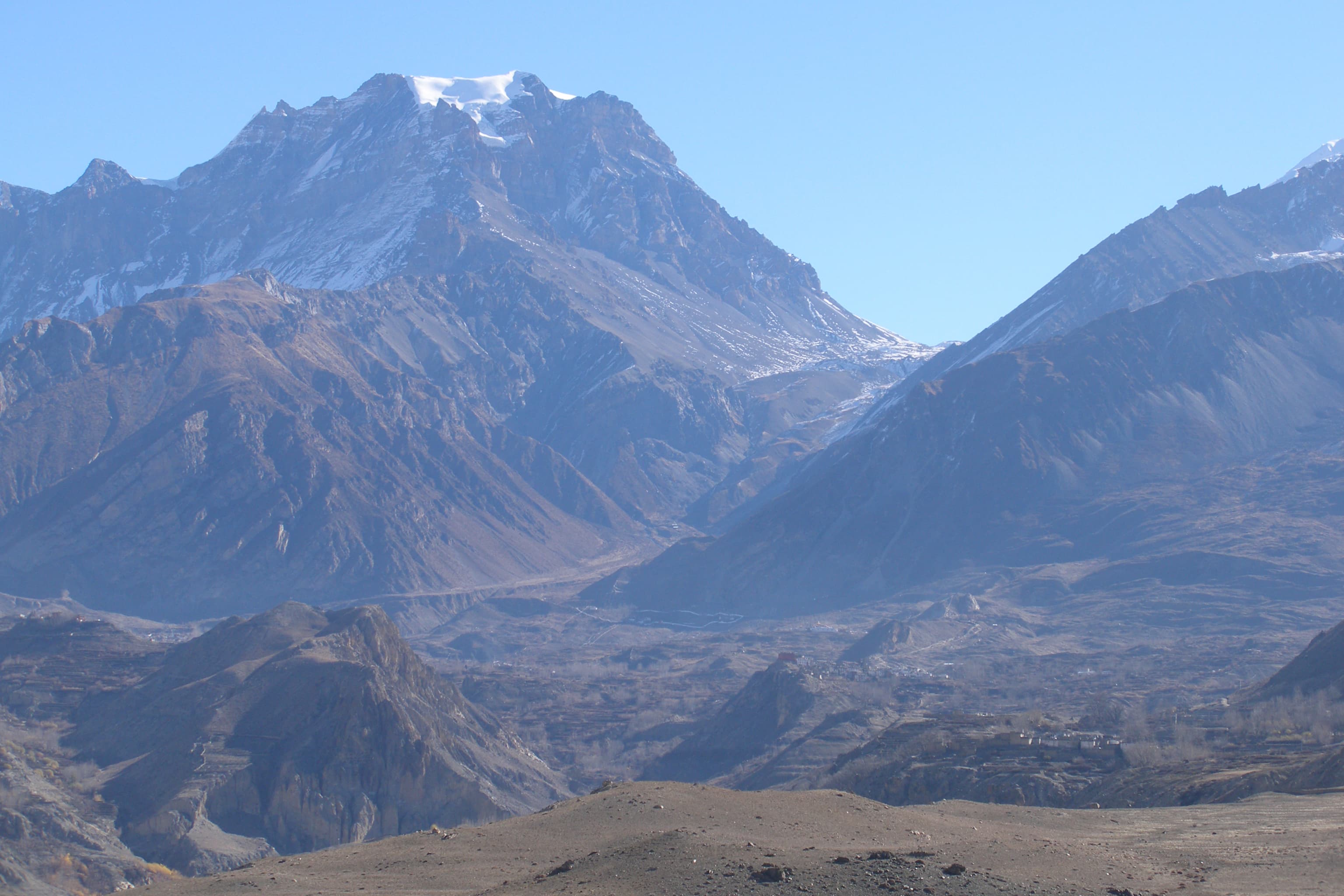
Descend into the Kali Gandaki gorge, the deepest river gorge on earth.
Read the dayShow less
The Kali Gandaki gorge is flanked by Annapurna I (8,091 m) to the east and Dhaulagiri (8,167 m) to the west — the greatest altitude differential of any river gorge on the planet. Afternoon winds are strong and constant from noon; start early.
Day 12
Jomsom to Marpha and Tukuche
- 2,590 m
- Down 130 m
- 14 km
- 4 to 5 h
- Sleep: Tukuche
Walk through Marpha, famous for its apple orchards, apple brandy and white-washed Thakali village architecture.
Read the dayShow less
Marpha is the most aesthetically striking village on the circuit. Flat-roofed stone houses, covered alleyways, and apple trees everywhere. Try the local apple cider and apple pie.
Day 13
Tukuche to Kalopani
- 2,530 m
- Down 60 m
- 12 km
- 4 to 5 h
- Sleep: Kalopani
The gorge narrows and vegetation returns as altitude decreases.
Read the dayShow less
Kalopani has exceptional views of Dhaulagiri. The wind continues to be a challenge in the afternoons; start early.
Day 14
Kalopani to Tatopani
- 1,190 m
- Down 1,340 m
- 19 km
- 5 to 6 h
- Sleep: Tatopani
Descend dramatically to the Kali Gandaki valley floor. Hot springs await at Tatopani.
Read the dayShow less
Tatopani means 'hot water' in Nepali. The natural hot springs are a magnificent reward after the high altitude. Soak the tired legs in the geothermal pools.
Day 15
Tatopani to Ghorepani
- 2,860 m
- Up 1,670 m
- 18 km
- 7 to 8 h
- Sleep: Ghorepani
A tough re-ascent through rhododendron forest to the ridge at Ghorepani.
Read the dayShow less
This is one of the hardest days of the circuit in terms of sustained climbing. The forest is beautiful. Ghorepani at 2,860 m is the takeoff point for the famous Poon Hill sunrise viewpoint.
Day 16
Poon Hill sunrise, then descend to Nayapul for Pokhara
- 827 m
- Down 2,033 m
- 24 km
- 6 to 7 h
- Sleep: Pokhara
Pre-dawn hike to Poon Hill for the most photographed sunrise in Nepal, then complete the circuit.
Read the dayShow less
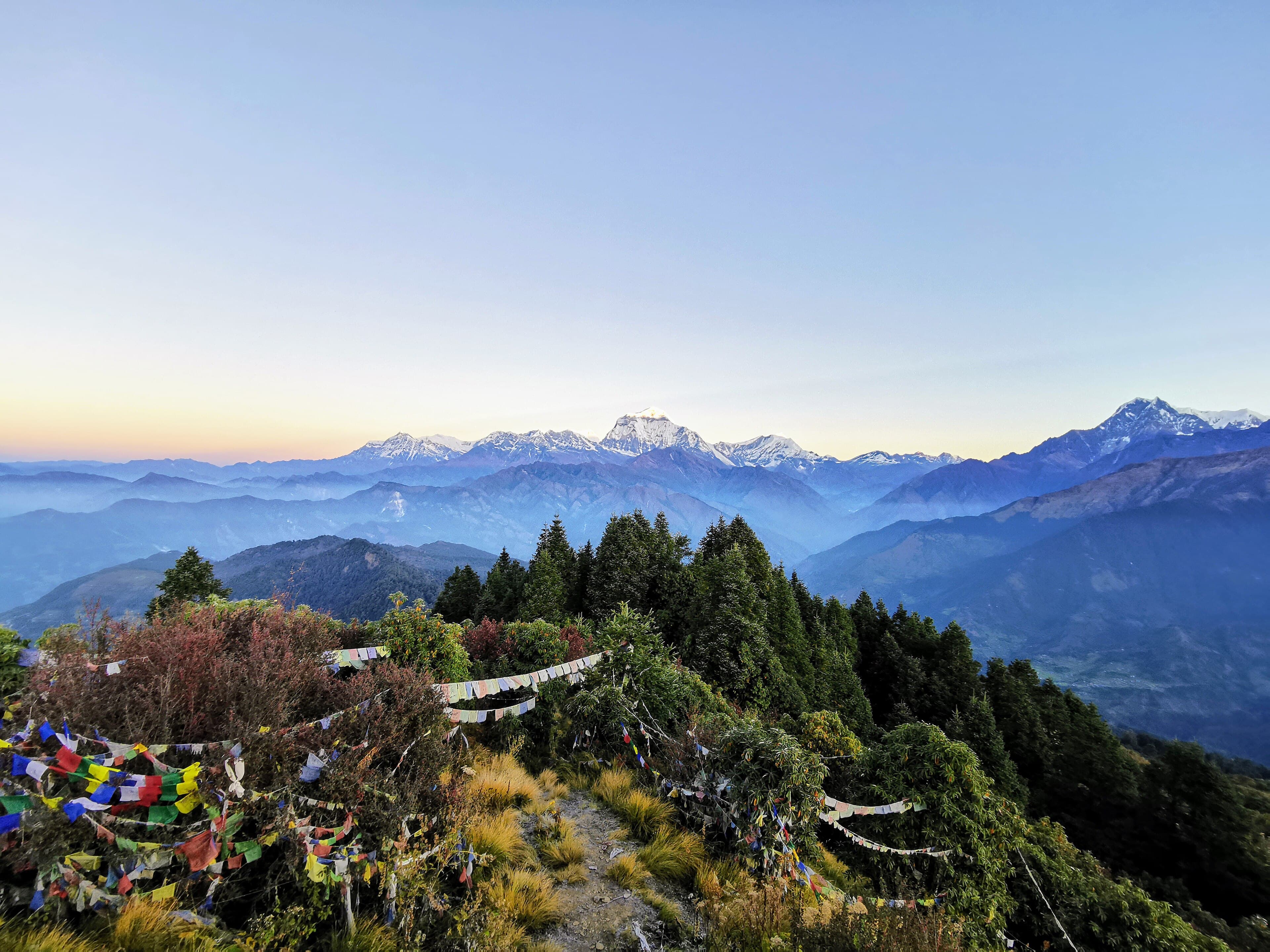
Leave Ghorepani at 4:30am for the 45-minute climb to Poon Hill (3,210 m). Dhaulagiri, Annapurna South, Hiunchuli, Machhapuchhre and many other peaks light up at sunrise. Descend through Tikhedhunga to Nayapul and take transport to Pokhara.
Transport: Taxi or bus from Nayapul to Pokhara (1 hour)
Highlight: Poon Hill sunrise: the most iconic mountain panorama in Nepal
What is included and what is not
The altitude and duration are the main challenges. The walking itself is rarely technical, but Thorong La at 5,416 m is the highest trekking pass in the world that is regularly crossed and demands thorough acclimatisation at Manang.
Included in a guided price
Permitsabout $$35
ACAP and TIMS
Accommodationabout $$150–220
15 nights teahouse twin-share
Mealsabout $$140–200
Breakfast and dinner on trail
Guideabout $$280–400
Licensed English-speaking guide
Porterabout $$200–280
One per two trekkers
Not included, budget for it
International flights
To and from Kathmandu or Pokhara
Travel insurance
Must cover helicopter evacuation
Personal gear
Sleeping bag, down jacket, poles
Permits for the Annapurna Circuit Trek
Annapurna Conservation Area Permit (ACAP)
Issued by National Trust for Nature Conservation
- Foreign
- NPR 3,000
- SAARC
- NPR 1,500
Buy at the NTB office in Kathmandu, NTNC office in Pokhara, or at the Besisahar checkpost.
TIMS Card
Issued by Nepal Tourism Board
- Foreign
- NPR 2,000
- SAARC
- NPR 1,000
Available at NTB offices in Kathmandu and Pokhara. Required along with ACAP.
What to pack
Good general fitness for walking 5 to 7 hours per day for two weeks. The Thorong La crossing day is 8 to 10 hours.
Clothing
- Down jacket
- Fleece mid-layer
- Waterproof shell
- Thermal base layers
- Warm hat and gloves
- Sun hat and sunglasses
Footwear
- Waterproof trekking boots
- Trekking sandals
- 4 pairs trekking socks
Equipment
- Trekking poles
- Sleeping bag -10°C
- Daypack 25L
- Headtorch
Health
- Altitude medication (consult doctor)
- Water purification
- Sunscreen SPF50+
- First aid kit
Frequently asked questions
Sources checked
- NTNC Annapurna Conservation AreaNational Trust for Nature Conservation, checked 15 January 2025
Fees and regulations in Nepal change. This page was last verified on 15 January 2025.