Last checked
Key facts
- Duration
- 18 days from Tumlingtar
- Highest point
- 4,870 m (15,978 ft) at Makalu Base Camp
- Total distance
- 145 km
- Difficulty
- Strenuous, 4 of 5
- Best months
- March to May and October to November
- Months to avoid
- January to February and June to August
- Starts and ends
- Num (via Tumlingtar flight and jeep) to Num / Tumlingtar
- Accommodation
- Teahouse lodges
- Permits
- Makalu Barun National Park Permit, Makalu Rural Municipality Entry Fee
- Typical cost
- $1,450 to $2,200 per person, guided
- Experience needed
- Previous Himalayan trekking experience such as Everest Base Camp or Annapurna Circuit is highly recommended.
What makes the Barun Valley so special?
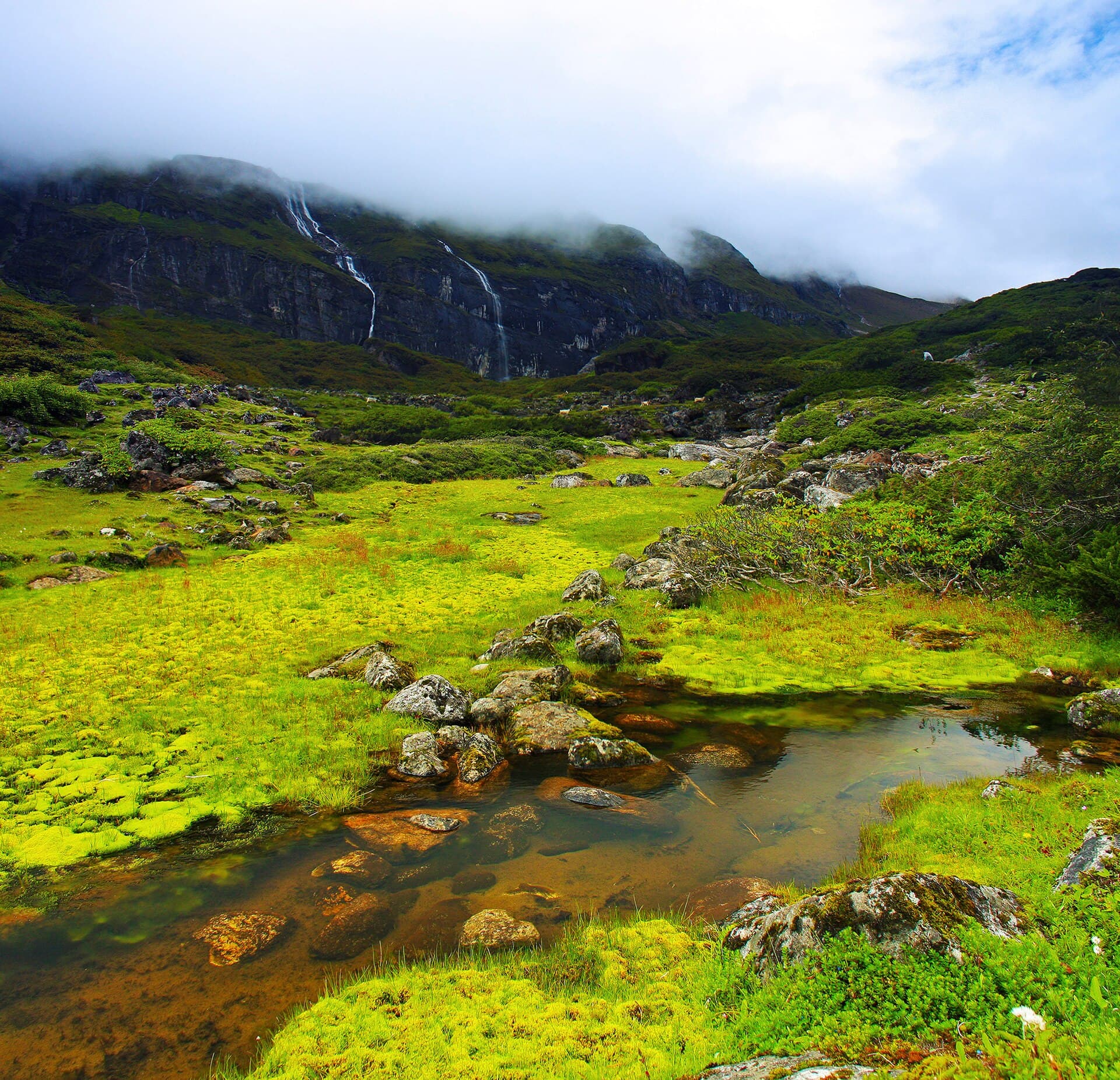
The Barun Valley is a virtually uninhabited ecological sanctuary of vertical granite spires, cascading waterfalls, and rare wildlife. Protected inside Makalu Barun National Park, it preserves untouched biodiversity ranging from tropical sal forests to arctic mountain glaciers.
The valley's sheer granite cliffs rival Yosemite in scale, rising directly above lush meadows filled with wildflowers.
It is home to endangered wildlife including the red panda, snow leopard, and over 400 species of birds.
Because no permanent villages exist above Tashigaon, the valley maintains an absolute feeling of remote wilderness.
How physically difficult is the Makalu Base Camp trek?
Makalu Base Camp is widely regarded as one of Nepal's most physically demanding teahouse treks. Trekkers must endure the steep 800 m drop and climb of the Arun gorge, followed by the quadruple pass crossing of Shipton La at 4,210 m in both directions.
The total cumulative elevation gain and loss exceeds that of the Everest Base Camp trek.
Weather in the upper Barun Valley can change rapidly, with cloud and cold rain common even during spring.
Teahouse facilities above Tashigaon are simple, rustic, and operate with limited menus and wood-burning stoves.
Makalu Base Camp Trek itinerary, day by day
The full 18 day schedule, with sleeping altitude, walking hours and overnight stop for every day. The acclimatisation days are the ones that decide whether people finish.
Day 1
Flight to Tumlingtar and drive to Num
- 1,560 m
- Up 160 m
- 50 km
- 1 h
- Sleep: Num
Fly from Kathmandu to Tumlingtar airstrip in the Arun valley and drive by four-wheel-drive jeep up the ridge to Num.
Read the dayShow less
The flight offers sweeping aerial views of the eastern Himalayas including Everest, Makalu, and Kanchenjunga.
Num sits perched high on a ridge looking directly across the steep Arun river canyon.
Transport: 45 min flight to Tumlingtar, 4 hour jeep drive to Num
Highlight: Flight views of Makalu and Kanchenjunga
Day 2
Num to Seduwa
- 1,500 m
- Down 60 m
- 8 km
- 5 h
- Sleep: Seduwa
Descend steeply down into the humid Arun river gorge and climb up the opposite bank to Seduwa.
Read the dayShow less
Drop 800 vertical meters through bamboo groves to cross the Arun river suspension bridge.
Climb stone steps up the opposite wall to register permits at Seduwa national park office.
Highlight: Crossing the wild Arun River canyon
Day 3
Seduwa to Tashigaon
- 2,100 m
- Up 600 m
- 9 km
- 4 to 5 h
- Sleep: Tashigaon
Walk past terraced rice paddies and cardamom fields into the scenic Sherpa settlement of Tashigaon.
Read the dayShow less
Gentle climbing along hillside contours through fertile farming communities.
Tashigaon is the last permanent village on the route before entering uninhabited wilderness.
Highlight: Traditional Sherpa village of Tashigaon
Day 4
Tashigaon to Khongma Danda
- 3,500 m
- Up 1,400 m
- 8.5 km
- 6 h
- Sleep: Khongma Danda
A steep and unrelenting climb through mossy cloud forests of rhododendron and oak up to Khongma ridge.
Read the dayShow less
Ascend thousands of stone steps out of the cloud forest onto an open ridge.
Khongma ridge offers crisp sunset views across eastern mountain valleys.
Highlight: Climbing through ancient moss-draped cloud forest
Day 5
Acclimatization day at Khongma Danda
- 3,500 m
- Up 250 m
- 4 km
- 3 h
- Sleep: Khongma Danda
Spend a vital acclimatization day resting and taking short walks along the ridge before tackling Shipton La.
Read the dayShow less
Acclimatization at 3,500 m prepares the body for the quadruple pass crossings ahead.
Enjoy clear morning views of Mount Chamlang and the peaks of the Barun divide.
Highlight: Panoramic mountain photography on the ridge
Day 6
Cross Shipton La to Dobato
- 3,800 m
- Up 710 m
- 11 km
- 7 to 8 h
- Sleep: Dobato
Cross four high alpine passes including Ghungru La, Shipton La (4,210 m), and Keke La before dropping to Dobato.
Read the dayShow less
Pass the holy turquoise lake of Kalo Pokhari surrounded by Buddhist prayer flags.
Shipton La is named after the legendary Himalayan explorer Eric Shipton.
Descend steeply through pine and birch forest to reach the clearing at Dobato.
Highlight: Crossing historic Shipton La Pass (4,210 m)
Day 7
Dobato to Yangle Kharka
- 3,557 m
- Down 243 m
- 10 km
- 5 to 6 h
- Sleep: Yangle Kharka
Descend into the sheer-sided glacial trough of the Barun River valley and follow its rushing alpine waters.
Read the dayShow less
Enter one of the deepest mountain gorges on Earth with 1,000-meter granite cliffs on either side.
Yangle Kharka is an idyllic grassy meadow beside the river with a small Buddhist monastery.
Highlight: Entering the dramatic Barun River gorge
Day 8
Yangle Kharka to Langmale Kharka
- 4,410 m
- Up 853 m
- 11 km
- 5 to 6 h
- Sleep: Langmale Kharka
Ascend past alpine pastures, glacial moraines, and cascading waterfalls to high Langmale Kharka.
Read the dayShow less
Pass sacred cliffside meditation caves and prayer walls along the valley floor.
Look up at sheer granite monoliths echoing the geography of Yosemite Valley.
Highlight: Towering vertical granite walls of Barun Valley
Day 9
Langmale Kharka to Makalu Base Camp
- 4,870 m
- Up 460 m
- 8 km
- 4 to 5 h
- Sleep: Makalu Base Camp
Climb past the snout of the Barun Glacier onto the high alpine plateau of Makalu Base Camp.
Read the dayShow less
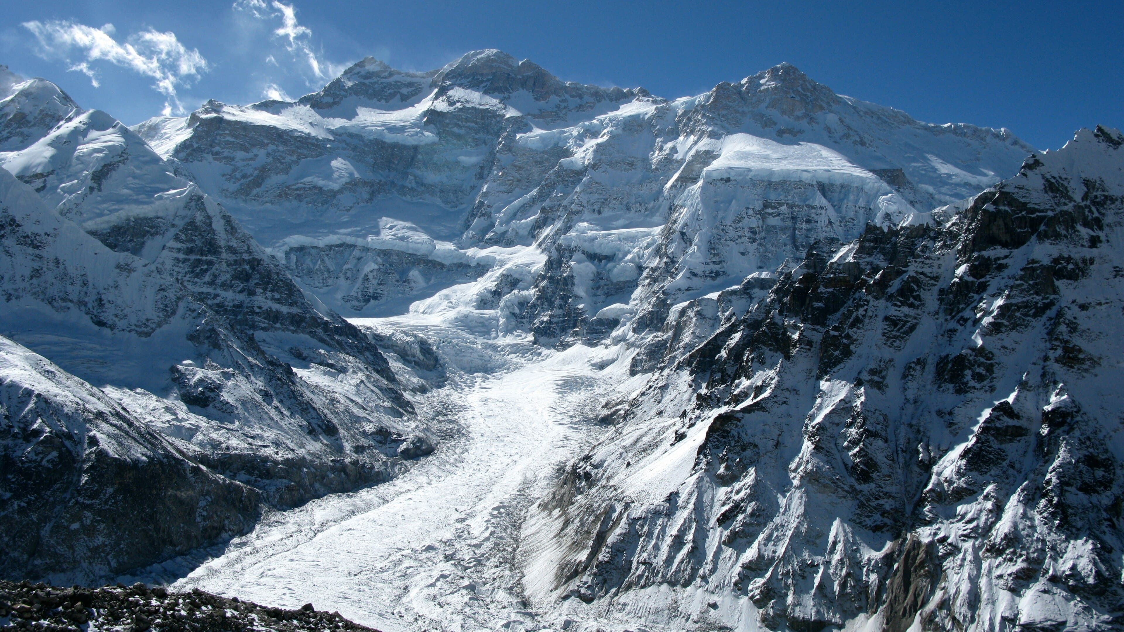
Emerge into a massive glacial amphitheater dominated by Mount Makalu (8,485 m).
The south face of Makalu rises sheer above the base camp in a wall of dark rock and hanging glaciers.
Highlight: Close-up view of Mount Makalu (8,485 m)
Day 10
Exploration day at Makalu Base Camp
- 5,100 m
- Up 230 m
- 6 km
- 4 h
- Sleep: Makalu Base Camp
Explore the ridges above the Barun Glacier with panoramas of Everest, Lhotse, and the sheer face of Makalu.
Read the dayShow less
Hike to the viewpoint ridge overlooking the Kangshung face of Mount Everest and Lhotse.
Watch hanging avalanches tumble harmlessly onto the distant Barun glacier.
Highlight: Viewpoint overlooking Everest and Lhotse
Day 11
Makalu Base Camp to Yangle Kharka
- 3,557 m
- Down 1,313 m
- 19 km
- 6 to 7 h
- Sleep: Yangle Kharka
Begin the return journey down the Barun valley to the welcoming pastures of Yangle Kharka.
Read the dayShow less
Descend alongside roaring glacial streams under the granite walls of the canyon.
Enjoy richer air and warmer evening temperatures in the valley.
Highlight: Fast descent with increasing oxygen
Day 12
Yangle Kharka to Dobato
- 3,800 m
- Up 243 m
- 10 km
- 5 h
- Sleep: Dobato
Climb out of the Barun River valley through birch groves back to Dobato clearing.
Read the dayShow less
A steady uphill climb exiting the river canyon floor.
Rest early in preparation for re-crossing the Shipton La passes.
Highlight: Final views looking back into Barun gorge
Day 13
Dobato over Shipton La to Khongma Danda
- 3,500 m
- Up 410 m
- 11 km
- 6 to 7 h
- Sleep: Khongma Danda
Re-cross the scenic Keke La, Shipton La, and Ghungru La passes back to Khongma ridge.
Read the dayShow less
Enjoy one last high-altitude view over sacred Kalo Pokhari lake.
Arrive at Khongma teahouses for hot dal bhat and a restful evening.
Highlight: Re-crossing the Shipton La passes
Day 14
Khongma Danda to Tashigaon
- 2,100 m
- Down 1,400 m
- 8.5 km
- 5 h
- Sleep: Tashigaon
Descend the thousands of stone staircases through the cloud forest back to human settlements at Tashigaon.
Read the dayShow less
Drop down past mossy rhododendron trunks into warm subtropical air.
Celebrate with fresh village vegetables and warm Sherpa hospitality.
Highlight: Return to welcoming village life
Day 15
Tashigaon to Seduwa
- 1,500 m
- Down 600 m
- 9 km
- 4 h
- Sleep: Seduwa
Walk past terraced hillsides, school courtyards, and cardamom plants to Seduwa.
Read the dayShow less
Relaxed walking through rural farming landscapes.
Check out at the national park administrative gate.
Highlight: Terraced farming valleys of Sankhuwasabha
Day 16
Seduwa to Num
- 1,560 m
- Up 60 m
- 8 km
- 5 h
- Sleep: Num
Descend to the Arun river suspension bridge and tackle the final 800-meter climb up to Num ridge.
Read the dayShow less
The steep ascent up to Num provides a rewarding final workout.
Reach the roadhead teahouse for celebration drinks with your guide and porter crew.
Highlight: Conquering the steep Arun river climb
Day 17
Num drive to Tumlingtar
- 510 m
- Down 1,050 m
- 50 km
- 0 h
- Sleep: Tumlingtar (Hotel)
Drive down the mountain ridge back to Tumlingtar beside the wide Arun river.
Read the dayShow less
Scenic bumpy jeep drive through lush foothills and bazaar towns.
Stay at a comfortable hotel adjacent to Tumlingtar airport.
Transport: 4 hour jeep drive from Num to Tumlingtar
Highlight: Return to Tumlingtar valley
Day 18
Flight from Tumlingtar to Kathmandu
- 1,400 m
- Up 890 m
- 180 km
- 0 h
- Sleep: Kathmandu (Hotel)
Fly back to Kathmandu with breathtaking views of the eastern Himalayas.
Read the dayShow less
Reflect on completing one of Nepal's most wild and demanding base camp expeditions.
Transfer to hotel in Kathmandu for warm showers and celebration.
Transport: 45 min flight from Tumlingtar to Kathmandu
Highlight: Scenic flight over the Himalayan range
What is included and what is not
Demanding high-altitude crossing of Shipton La at 4,210 m with steep climbs and descents. The upper Barun valley is remote with simple teahouses and unpredictable mountain weather.
Included in a guided price
Park and local permits
Makalu Barun National Park permit and rural municipality entry card.
Certified mountain guide
Experienced mountain trekking guide with wilderness first aid.
Lodge accommodation
Seventeen nights in teahouses and local mountain lodges.
Domestic airfare & jeeps
Round-trip flights to Tumlingtar and jeep transfers to Num.
Not included, budget for it
Travel insurance
Comprehensive high-altitude medical and helicopter evacuation insurance.
Personal electronics charging
Fees charged for solar battery charging in remote Barun valley.
Snacks and boiled drinking water
Extra beverages, snacks, and boiled water bottles at high lodges.
Permits for the Makalu Base Camp Trek
Makalu Barun National Park Permit
Issued by Department of National Parks and Wildlife Conservation
- Foreign
- NPR 3,000
- SAARC
- NPR 1,500
National park conservation permit obtained in Kathmandu or at the Seduwa entrance gate.
Makalu Rural Municipality Entry Fee
Issued by Makalu Rural Municipality
- Foreign
- NPR 2,000
- SAARC
- NPR 1,000
Local government infrastructure development fee paid at checkpost.
What to pack
High physical stamina for steep mountain stairs, rugged moraine trails, and significant cumulative elevation gain and loss.
Footwear
- Sturdy waterproof mountaineering or trekking boots
- Spare laces
- Gaiters for mud and scree
- Heavyweight wool socks
Cold weather gear
- High-fill down jacket (-15C rating)
- Gore-Tex outer shell jacket and pants
- Mid-layer fleece pullover
- Merino wool thermal tops and bottoms
Personal accessories
- Sleeping bag rated to -15C
- Trekking poles with spare baskets
- UV category 4 sunglasses
- Heavy-duty power banks
Frequently asked questions
Sources checked
- Department of National Parks and Wildlife ConservationGovernment of Nepal, checked 10 October 2026
Fees and regulations in Nepal change. This page was last verified on 10 October 2026.