Last checked
Key facts
- Duration
- 22 days round trip from Juphal
- Highest point
- 5,350 m (17,552 ft) at Kang La Pass
- Total distance
- 220 km
- Difficulty
- Extreme, 5 of 5
- Best months
- May to October
- Months to avoid
- January to February and December
- Starts and ends
- Juphal (via Nepalgunj flight) to Juphal
- Accommodation
- camping
- Permits
- Upper Dolpo Restricted Area Permit (RAP), Shey Phoksundo National Park Permit
- Typical cost
- $2,800 to $4,400 per person, guided
- Experience needed
- Extensive prior high-altitude trekking experience over 5,000 meters is an absolute prerequisite.
Why is Upper Dolpo the ultimate wilderness trek?
Tucked behind the Dhaulagiri massif on the Tibetan plateau, Upper Dolpo is cut off by towering mountain passes that are snowbound for half the year. It possesses no motor roads, no commercial teahouses, and preserves a pre-Buddhist Bon Po way of life that has vanished elsewhere.
Villagers continue ancestral caravan migrations across Himalayan passes to trade grain for Tibetan rock salt.
The region was chronicled in Peter Matthiessen's bestselling 1978 book 'The Snow Leopard' and Eric Valli's Oscar-nominated film 'Himalaya'.
Trekkers must be completely self-reliant with camping logistics, food supplies, and medical equipment.
Can you trek Upper Dolpo during the summer monsoon?
Yes. Upper Dolpo sits in the rain shadow of the high Himalayas, meaning the region receives virtually no monsoon rain from June through August while the rest of Nepal experiences heavy downpours.
Summer is the prime agricultural season in Dolpo when high meadows blossom with wildflowers and barley fields turn bright green.
However, internal flights between Nepalgunj and Juphal can face weather delays due to cloud cover in the southern lowlands.
September and October provide crisp stable autumn weather with crystal-clear skies across all high mountain passes.
Upper Dolpo Circuit Trek itinerary, day by day
The full 22 day schedule, with sleeping altitude, walking hours and overnight stop for every day. The acclimatisation days are the ones that decide whether people finish.
Day 1
Flight from Nepalgunj to Juphal and trek to Dunai
- 2,140 m
- Down 330 m
- 10 km
- 3 h
- Sleep: Dunai
Fly into the mountains of Dolpa and hike downstream beside the Thuli Bheri river to district headquarters at Dunai.
Read the dayShow less
Meet the expedition crew of Sherpa guides, cook team, and pack mules at Juphal airstrip.
Dunai features the final government administrative services and police checkpoints.
Transport: Morning 35 min flight from Nepalgunj to Juphal
Highlight: Flying into remote Juphal airstrip
Day 2
Dunai to Chhepka
- 2,838 m
- Up 698 m
- 15 km
- 6 h
- Sleep: Chhepka
Enter Shey Phoksundo National Park and ascend alongside the roaring turquoise Phoksundo Khola.
Read the dayShow less
Pass through dense bamboo and pine forests filled with wild walnut and cedar trees.
Register park permits at the military checkpoint in Sulighat.
Highlight: Entering Shey Phoksundo National Park
Day 3
Chhepka to Jharana Hotel
- 3,110 m
- Up 272 m
- 12 km
- 5 h
- Sleep: Jharana
Climb past the confluence of Suli Gad and Phoksundo Khola to a viewpoint opposite Nepal's highest waterfall.
Read the dayShow less
Gaze across the valley at the thundering 167-meter Suligad waterfall draining Lake Phoksundo.
Catch your first distant glimpse of the turquoise sheen of the lake from the ridge top.
Highlight: 167-meter Suligad Waterfall view
Day 4
Jharana to Ringmo and Shey Phoksundo Lake
- 3,611 m
- Up 501 m
- 8 km
- 4 h
- Sleep: Ringmo Lake Camp
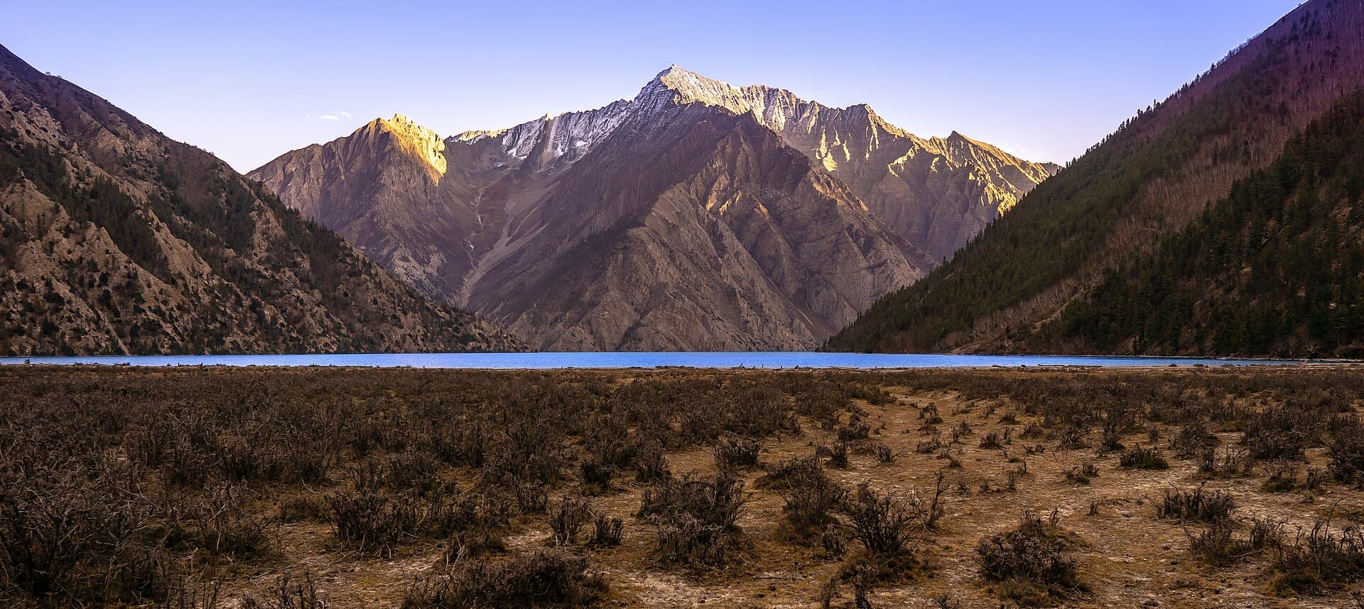
Descend into birch groves and climb to the traditional Bon village of Ringmo on the shores of Lake Phoksundo.
Read the dayShow less
Lake Phoksundo is an alpine wonder: 145 meters deep with no aquatic life, giving it intense cobalt color.
Ringmo village preserves centuries-old Bon Po culture with counter-clockwise prayer wheels.
Highlight: Arrival at deep turquoise Shey Phoksundo Lake
Day 5
Rest and exploration at Phoksundo Lake
- 3,611 m
- Up 100 m
- 5 km
- 3 h
- Sleep: Ringmo Lake Camp
Spend a full acclimatization day visiting the ancient Bon monastery of Pal Sentan Thasung Chholing Gompa.
Read the dayShow less
Walk along the lake's southern shoreline to the 900-year-old cliffside Bon monastery.
Acclimatize in preparation for the severe 5,000 m mountain passes ahead.
Highlight: 900-year-old Bon monastery
Day 6
Ringmo to Phoksundo Khola Camp
- 3,750 m
- Up 139 m
- 11 km
- 5 to 6 h
- Sleep: Phoksundo Khola Camp
Follow the dramatic cliff trail made famous in Eric Valli's movie Himalaya along the lake's sheer western precipice.
Read the dayShow less
The 'devil's trail' is narrow and supported by wooden logs cantilevered out over the abyss.
Camp in pine and birch forests at the western inlet where the river feeds the lake.
Highlight: Cliff-hanging trail along Lake Phoksundo
Day 7
Phoksundo Khola to Kang La High Camp
- 4,500 m
- Up 750 m
- 9 km
- 5 to 6 h
- Sleep: Kang La Base Camp
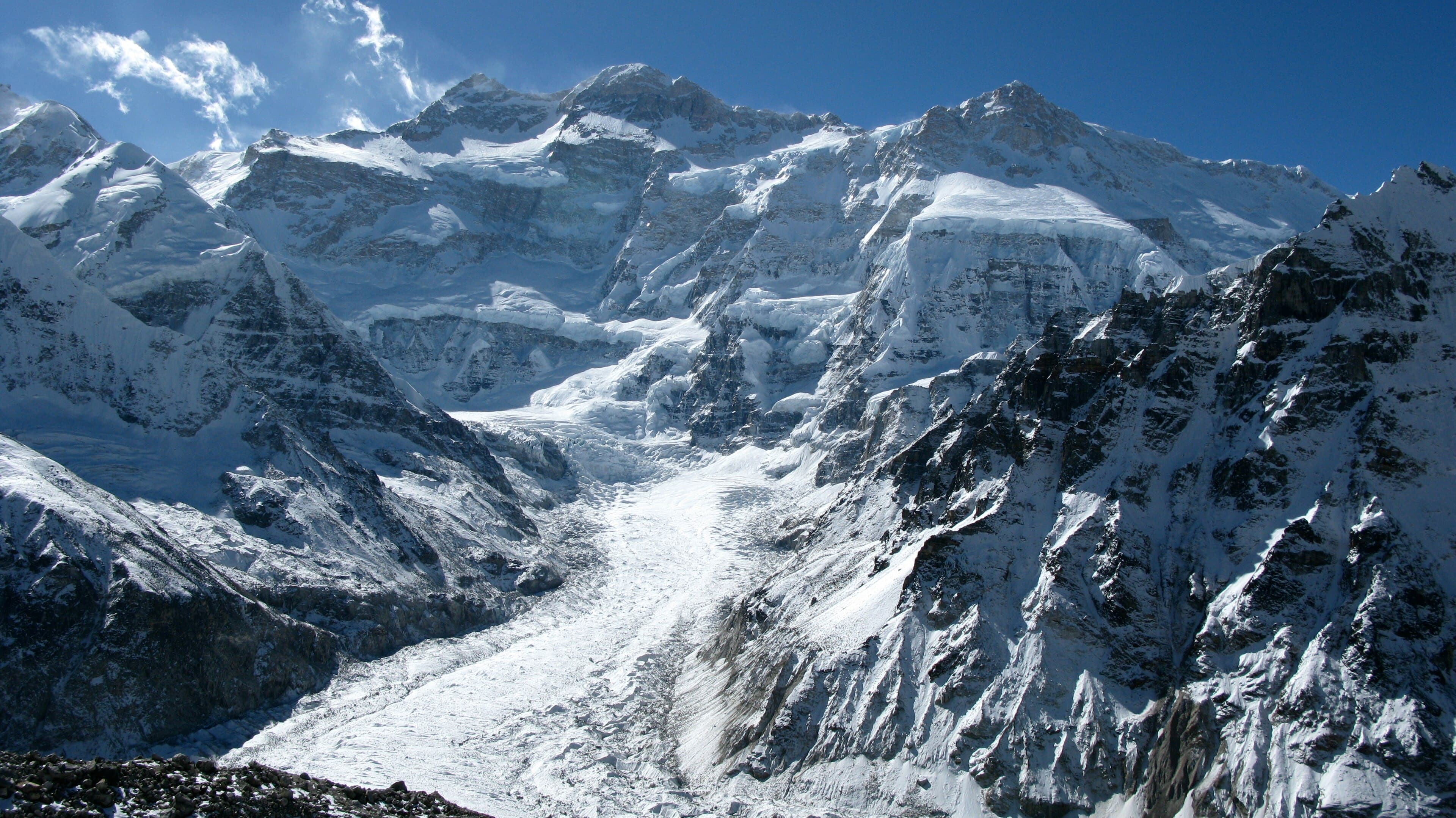
Ascend a desolate glacial valley through barren scree to pitch camp beneath the looming wall of Kang La.
Read the dayShow less
Leave trees behind as the route enters the arid trans-Himalayan rain shadow plateau.
Prepare cold weather clothing for a sub-zero night in high alpine wilderness.
Highlight: Stark trans-Himalayan glacial valley
Day 8
Cross Kang La Pass to Shey Gompa
- 5,350 m
- Up 850 m
- 14 km
- 7 to 8 h
- Sleep: Shey Gompa
Climb through steep gravel gullies to cross the 5,350 m Kang La Pass and descend into mythical Shey Gompa.
Read the dayShow less
From the pass, gaze across the barren valleys of Upper Dolpo extending toward Tibet.
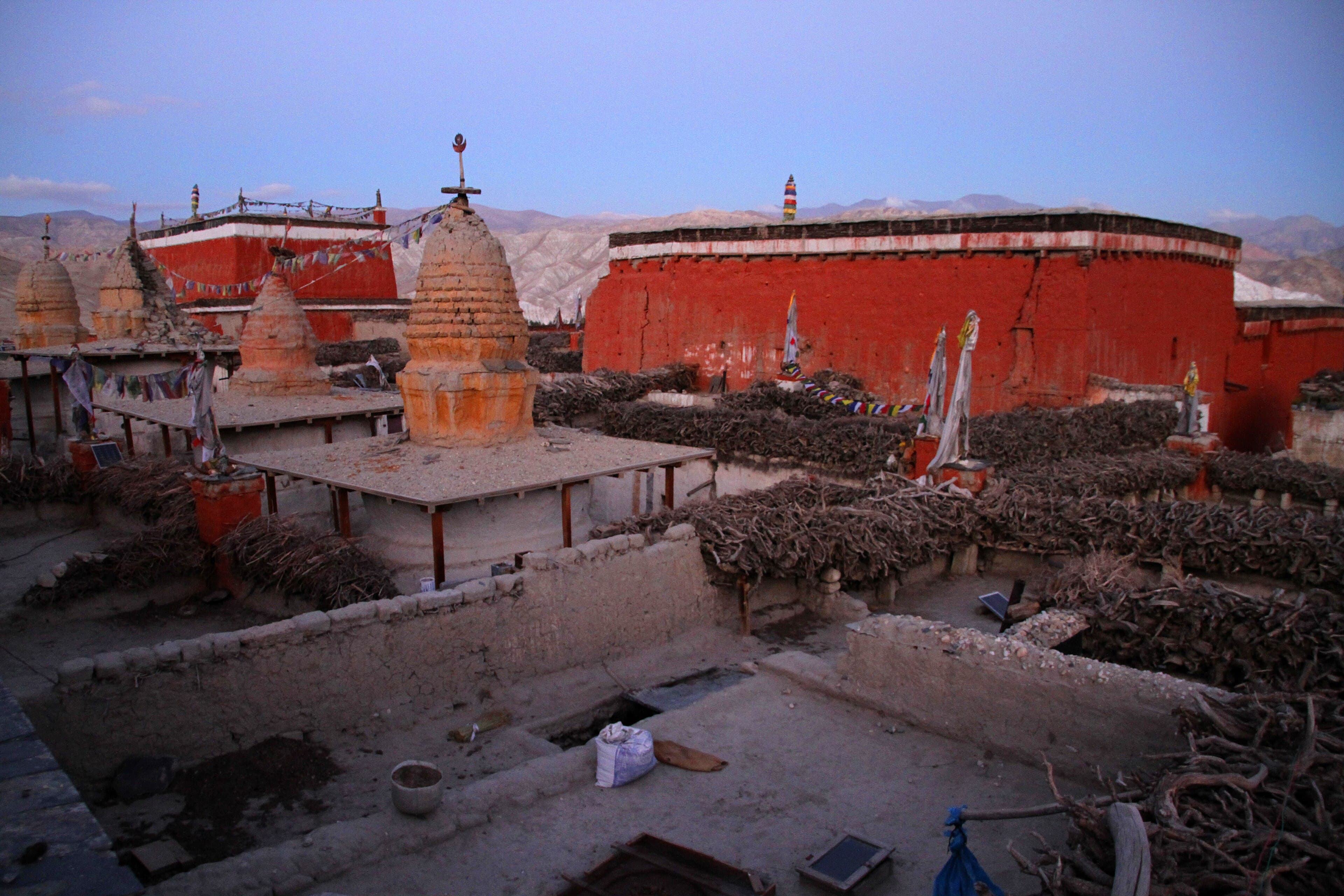
Camp beside the 11th century Shey Gompa sitting beneath the sacred Crystal Mountain.
Highlight: Summit of Kang La Pass (5,350 m)
Day 9
Rest and spiritual exploration at Shey Gompa
- 4,280 m
- Up 200 m
- 6 km
- 3 to 4 h
- Sleep: Shey Gompa
Explore the ancient monastery of Shey Gompa, celebrated in Peter Matthiessen's classic book The Snow Leopard.
Read the dayShow less
Visit the meditation caves and ancient scroll libraries of the Kagyupa Buddhist monastery.
Circumambulate parts of the sacred Crystal Mountain (Shel-ri).
Highlight: 11th century Shey Gompa and Crystal Mountain
Day 10
Shey Gompa to Namgung via Saldang La
- 4,430 m
- Up 920 m
- 13 km
- 6 h
- Sleep: Namgung
Cross the Saldang La (5,200 m) pass and drop down into the deep red and ochre earth canyons of Namgung.
Read the dayShow less
The landscape mirrors the arid Tibetan plateau with sweeping sand hills and eroded clay castles.
Visit Namgung Gompa nestled against towering sheer cliff walls.
Highlight: Saldang La pass and red clay canyons
Day 11
Namgung to Saldang Village
- 3,770 m
- Down 660 m
- 9 km
- 4 h
- Sleep: Saldang
Descend into the broad agricultural basin of Saldang, the largest and wealthiest settlement in Upper Dolpo.
Read the dayShow less
Saldang spreads across five hillside hamlets with fortified stone architecture.
Historic trade hub where salt caravans from Tibet exchange grain for wool.
Highlight: Ancient caravan village of Saldang
Day 12
Saldang to Yangjer Gompa excursion
- 4,590 m
- Up 820 m
- 14 km
- 6 h
- Sleep: Saldang
Day hike along the northern border trade trail to Yangjer Gompa, the richest Buddhist monastery in Dolpo.
Read the dayShow less
Follow the Nagon Khola through wild desert gorges near the frontier of Tibet.
View ancient gilded statues and historic silk thangkas inside Yangjer Gompa.
Highlight: Treasures of Yangjer Gompa
Day 13
Saldang to Komash Village
- 4,060 m
- Up 290 m
- 11 km
- 5 h
- Sleep: Komash
Traverse high arid contours above the river valley with views of blue sheep herds on the slopes.
Read the dayShow less
Spot herds of Himalayan blue sheep (bharal) and signs of the elusive snow leopard.
Camp beside the stone walled fields of peaceful Komash village.
Highlight: Wildlife spotting in trans-Himalayan valleys
Day 14
Komash to Shimen
- 3,870 m
- Up 400 m
- 12 km
- 5 to 6 h
- Sleep: Shimen
Cross a 4,500 m pass and descend through apricot groves and mani walls to Shimen village.
Read the dayShow less
Admire long mani walls etched with Tibetan sacred mantras along the ancient trade trails.
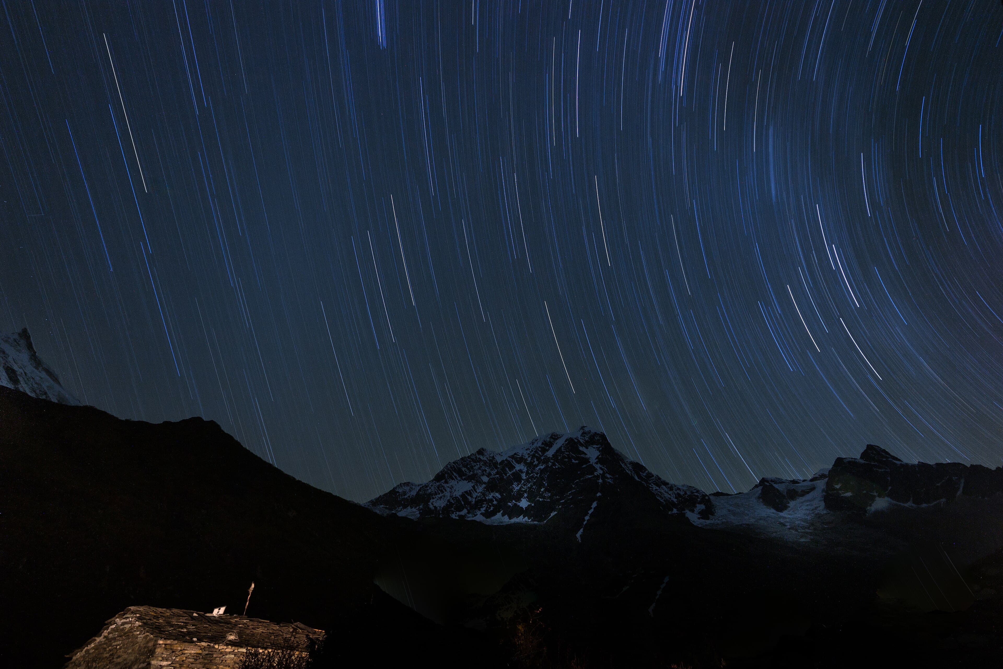
Camp under starry high-altitude skies.
Highlight: Centuries-old stone carved mani walls
Day 15
Shimen to Tinje Village
- 4,110 m
- Up 240 m
- 14 km
- 6 h
- Sleep: Tinje
Walk through wide sunny valleys alongside the Panjyang river to the sprawling pastures of Tinje.
Read the dayShow less
Tinje features an ancient airstrip plateau used for high-altitude supplies.
Interact with nomadic yak herders camping in traditional yak-hair tents.
Highlight: Nomadic yak pastoralism in Tinje
Day 16
Tinje to Yak Kharka
- 4,700 m
- Up 590 m
- 13 km
- 5 to 6 h
- Sleep: Yak Kharka
Climb past the river confluence toward the high grazing pastures beneath the Jeng La pass.
Read the dayShow less
Pitch camp in a secluded alpine meadow surrounded by grazing yaks.
Rest early for the demanding crossing of Jeng La the following morning.
Highlight: High alpine grazing pastures of Yak Kharka
Day 17
Cross Jeng La Pass to Tokyu and Dho Tarap
- 5,110 m
- Up 410 m
- 16 km
- 7 to 8 h
- Sleep: Dho Tarap
Cross the 5,110 m Jeng La pass with panorama of Dhaulagiri before descending into the fertile Dho Tarap valley.
Read the dayShow less
From Jeng La summit, gaze southward at the colossal north face of the Dhaulagiri massif.
Dho Tarap is the highest human permanent settlement in the world at 4,040 m.
Highlight: Jeng La Pass (5,110 m) & Dho Tarap valley
Day 18
Rest and monastery visits in Dho Tarap
- 4,040 m
- Up 100 m
- 5 km
- 3 h
- Sleep: Dho Tarap
Explore the fascinating mix of Bon Po and Nyingmapa Buddhist monasteries across the Dho Tarap valley.
Read the dayShow less
Visit Shipchhok Gompa and the Bon sanctuary on the valley rim.
Experience the daily life of Tarap residents who harvest barley in brief summer months.
Highlight: World's highest permanent village settlement
Day 19
Dho Tarap to Tarap Khola (Kamakharka)
- 3,800 m
- Down 240 m
- 15 km
- 6 h
- Sleep: Kamakharka
Enter the spectacular Tarap gorge where the trail drops down narrow stone stairways beside churning rapids.
Read the dayShow less
The river cuts through vertical canyon walls where bridges are replaced by timber planks.
Dramatic landscape transition from open desert into steep rocky canyon country.
Highlight: Stunning Tarap river gorge canyon
Day 20
Kamakharka to Tarakot
- 2,540 m
- Down 1,260 m
- 14 km
- 5 to 6 h
- Sleep: Tarakot
Descend out of the canyon to reach the ancient fortified hilltop village of Tarakot beside the Bheri river.
Read the dayShow less
Cross modern suspension bridges as the canyon widens into terraced agricultural valleys.
Tarakot was once a royal fort capital known as Dzong.
Highlight: Ancient fortress town of Tarakot
Day 21
Tarakot to Dunai and Juphal
- 2,470 m
- Down 70 m
- 18 km
- 6 to 7 h
- Sleep: Juphal
Follow the Bheri river valley back to Dunai and climb the final switchbacks to Juphal airstrip.
Read the dayShow less
Celebrate the completion of the three-week expedition with the trekking crew.
Repack equipment for the morning mountain flight.
Highlight: Closing celebration with expedition team
Day 22
Flight from Juphal to Nepalgunj and Kathmandu
- 1,400 m
- Down 1,070 m
- 350 km
- 0 h
- Sleep: Kathmandu (Hotel)
Early morning mountain flight over the foothills to Nepalgunj and connecting flight to Kathmandu.
Read the dayShow less
Gaze out the aircraft window at the jagged snow peaks of western Nepal.
Return to Kathmandu for comfortable hotel rest and well-earned relaxation.
Transport: Flight from Juphal to Nepalgunj, connecting flight to Kathmandu
Highlight: Scenic mountain flight back to Kathmandu
What is included and what is not
Rugged wilderness expedition crossing multiple 5,000 m mountain passes. Requires full camping logistics, self-sufficiency, and high endurance in remote trans-Himalayan desert country.
Included in a guided price
Restricted Area Permit
Upper Dolpo special permit covering the full expedition itinerary.
Park entry permit
Shey Phoksundo National Park conservation permissions.
Expedition crew
Licensed trekking guide, assistant guides, cook team, and pack animals.
Full camping logistics
Four-season tents, dining tent with gas heaters, toilet tent, and kitchen gear.
Not included, budget for it
Domestic airfare
Return flights connecting Kathmandu, Nepalgunj, and Juphal.
Emergency evacuation insurance
Compulsory comprehensive high-altitude search and helicopter rescue policy.
Personal gear and sleeping bag
Cold weather sleeping bag rated to -20C and personal clothing.
Permits for the Upper Dolpo Circuit Trek
Upper Dolpo Restricted Area Permit (RAP)
Issued by Department of Immigration Nepal
- Foreign
- NPR 67,500
- SAARC
- NPR 67,500
Costs USD 500 per person for the first 10 days, plus USD 50 for each additional day. Minimum two trekkers with licensed agency.
Shey Phoksundo National Park Permit
Issued by Department of National Parks and Wildlife Conservation
- Foreign
- NPR 3,000
- SAARC
- NPR 1,500
Park conservation fee for wildlife and habitat preservation.
What to pack
Elite mountain endurance and stamina to endure three straight weeks of camping, thin air, and consecutive 7 to 9 hour marching days.
Expedition sleeping
- Four-season sleeping bag (-20C rating)
- Inflatable sleeping mattress (high R-value)
- Silk sleeping bag liner
Alpine clothing
- Heavyweight expedition down parka
- Gore-Tex waterproof jacket and pants
- Multiple merino wool base layers
- Insulated mountaineering mitts
Expedition accessories
- Solar charger panel with high-capacity power bank
- Water filtration gravity filter
- Personal satellite messenger (Garmin InReach)
- Microspikes
Frequently asked questions
Sources checked
- Department of Immigration NepalGovernment of Nepal, checked 10 October 2026
Fees and regulations in Nepal change. This page was last verified on 10 October 2026.